📅 Visited: July 2025
We’d picked up a rental car at New Chitose Airport and were driving toward Date when it happened.
Two big mountains rose up dead ahead, straight out of the road.
One was massive and solid, its surface all rough and craggy.
And in front of it stood a smaller mountain — reddish-brown, round, and rounded off like a mound.
“That thing is huge!”
My wife and I said it in the same breath.
Only later did we learn that the red one was a mountain born out of a farmer’s field, barely eighty years ago.

Why is there such a young mountain here?
That question stayed tucked in a corner of my mind for the whole three days.
First, what Lake Toya actually is
On the way to our hotel, we pulled over at a spot with a view over Lake Toya.
It’s a wide, blue lake.
But look closely and — right in the middle of it, a green mountain floats.
An island in a lake isn’t unusual on its own.
But this wasn’t just an island: it was a rounded mountain, sitting out there on the water.
This mountain, called Nakajima, turned out to be the single biggest clue to what kind of lake Lake Toya really is.
A caldera is a large basin that forms when a huge volume of magma erupts all at once, leaving the ground above the emptied-out chamber to collapse inward.
Water then pooled in that round hollow — and that, it's said, is Lake Toya. Which is why the lake is shaped like a rounded bowl.
So why is there a mountain floating in the middle of that hollow? Because volcanic activity continued even after the caldera formed, and fresh magma welled up inside the basin to build a new mountain — that, it's said, is what Nakajima is.
In other words, Lake Toya is the scar of a giant eruption, and Nakajima is a volcano reborn inside that scar. The lake itself is a mirror reflecting the history of the volcano.
This one idea — a lake built by a volcano — would go on to tie together everything ahead of us: Showa-Shinzan, Mt. Usu, even the sea cliffs of Muroran.
I only fully grasped that on the final day, from the air.
| Location | Toyako-cho (Abuta District) and Sobetsu-cho (Usu District), Hokkaido |
| Features | A caldera lake formed by a massive eruption ~110,000 years ago; Nakajima at its center |
| Surroundings | Mt. Usu and Showa-Shinzan on the southern rim; sweeping views from the lookouts and Silo Observatory |
Showa-Shinzan — the red mountain born from a field
Before heading to the hotel, we went straight to the foot of that red mountain.
Showa-Shinzan.
Up close, its bare reddish-brown rock is exposed everywhere, and white steam drifts up from patches all across the surface.
The mountain is still hot — still breathing.
Hearing that this had been an empty field just eighty years ago sent a fresh shiver through me.
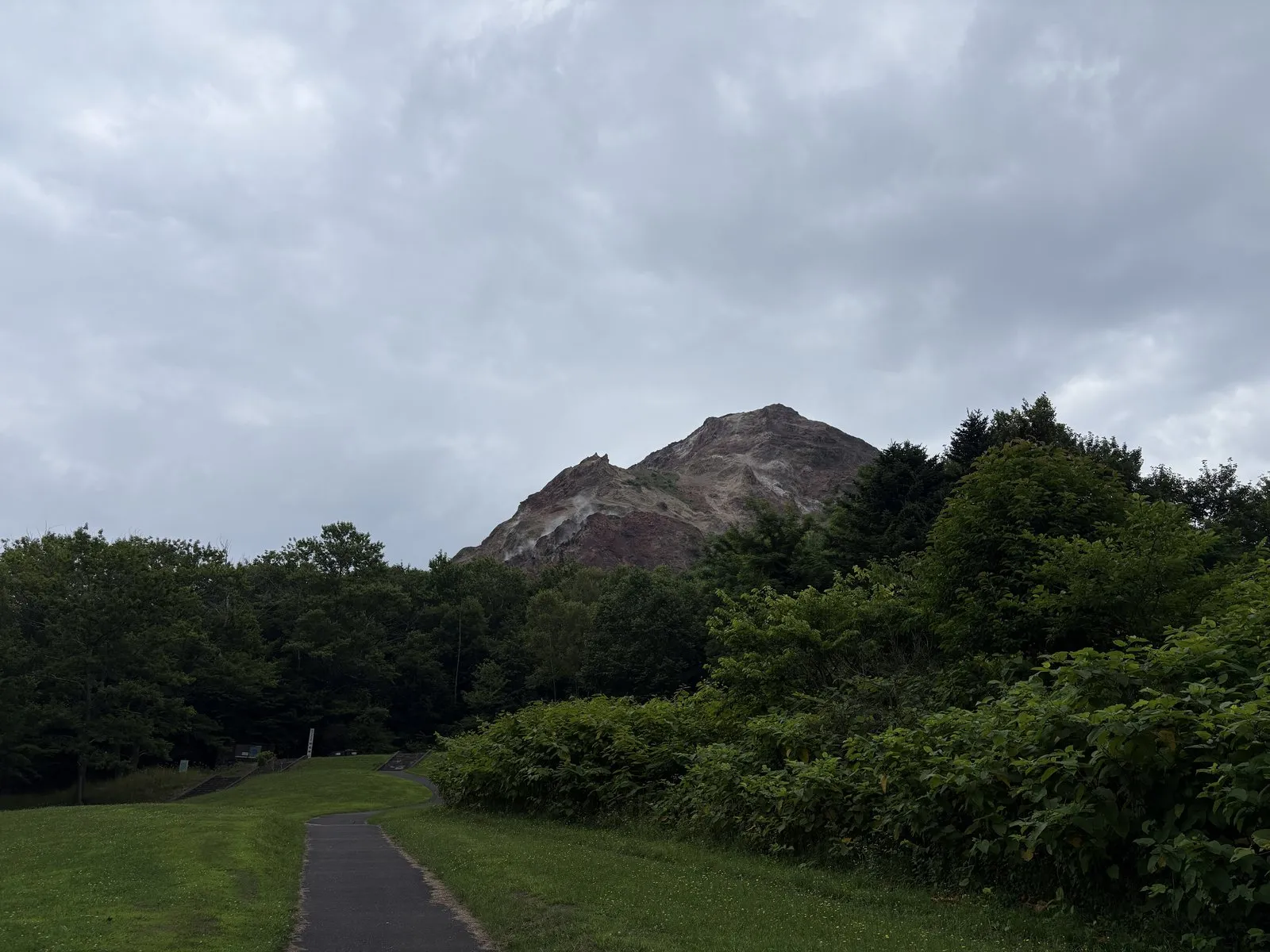

At the time, this area was a wheat field. Magma underground is said to have pushed the surface up, and the once-flat field slowly bulged higher and higher.
Eventually, thick, sticky magma rose up while hardening in place, forming a dome-shaped mountain. This is called a lava dome.
Its reddish-brown color is said to come from the lava (a type called dacite) being baked and oxidized at high temperature.
A local postmaster named Masao Mimatsu recorded this whole uplift in meticulous detail. His observations are known worldwide as a rare record of how a mountain is born and grows.
A flat field becoming a mountain in just a few years.
It made me feel that the earth moves faster than we tend to imagine.
We’d end up seeing this red mountain whole on the final day, from a helicopter.
Looking up at it from below, then down at it from above.
That contrast became one of the quiet pleasures of the trip.
Right next door is the Showa-Shinzan Bear Ranch, where cubs tumbled and wrestled all over each other — we couldn’t help stopping to watch.
| Location | Showa-Shinzan, Sobetsu-cho, Usu District, Hokkaido |
| Parking | Lot at the mountain's base (shared with the Mt. Usu Ropeway) |
| Note | Still steaming today; the Showa-Shinzan Bear Ranch is right beside it |
Mt. Usu Ropeway and the Ginnuma Crater — the raw face of an active volcano
From right beside Showa-Shinzan, we took the ropeway up to the top of Mt. Usu.
The fare is honestly a bit steep, but it stays cool even in summer, and the view opens up wider with every meter of climb.
From the summit observation deck we could see the Ginnuma Crater.
Rugged, jagged rock drops away like the inside of a mortar.
Not a gentle mountain wrapped in green, but a raw one, its bare skin still showing.
“So this is what an active volcano looks like.” We stood and stared.
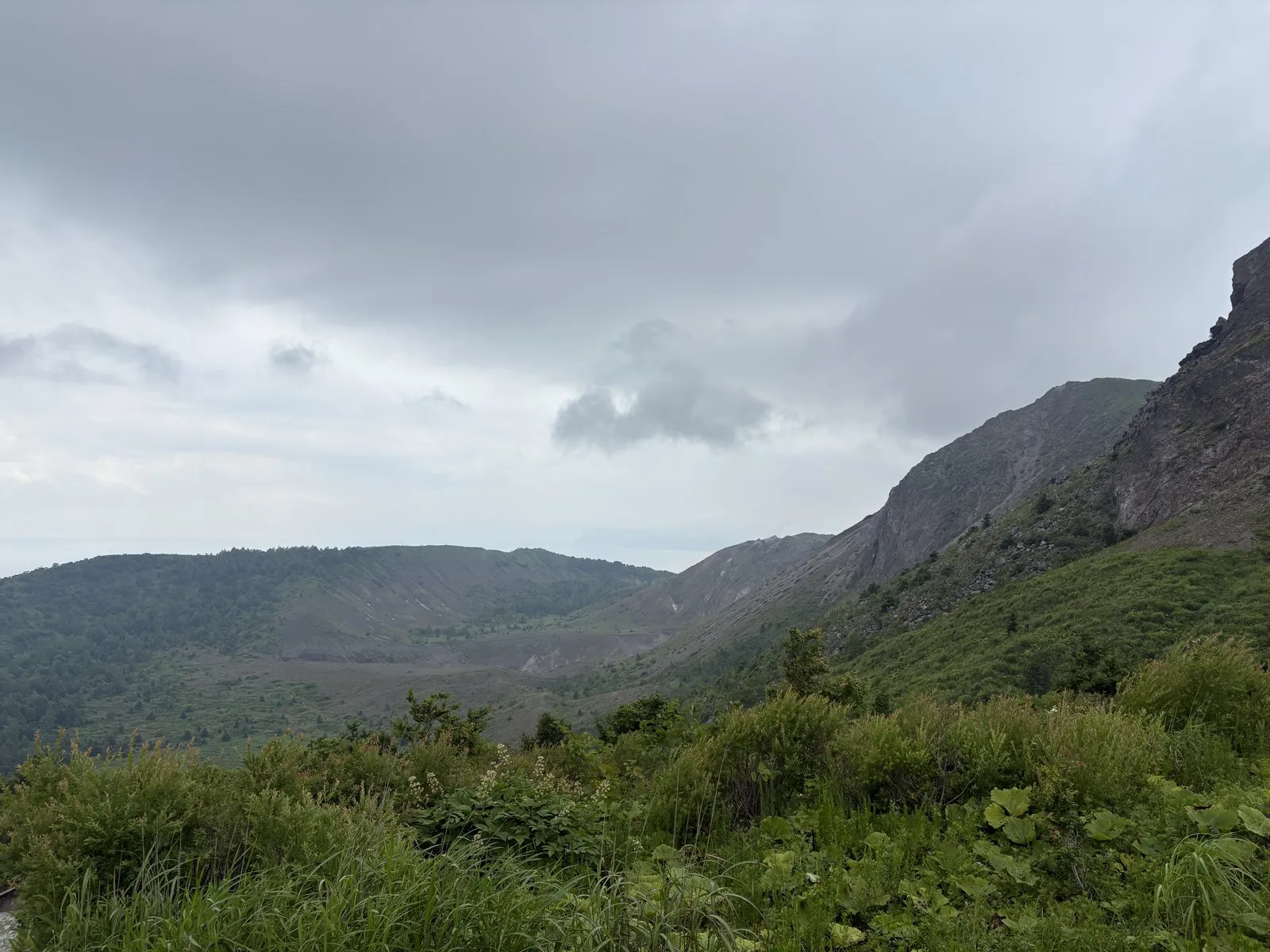
What sets it apart is how it has erupted again and again every few decades. In the 20th century alone it was active in 1910, 1943–45 (Showa-Shinzan), 1977, and 2000.
Mt. Usu's magma is sticky and viscous, so it tends to well up and harden near the vent. That's why lava domes like Showa-Shinzan form, and why the mountainside is left so rough and jagged.
Precisely because it erupts over and over, it never gets fully covered in green — it keeps the bare-skinned face of a "young mountain," or so it seemed to me.
Craggy and huge, it grew more imposing the closer we got.
Somehow, a rough, unfinished mountain like this lets you feel the raw force of the earth more directly than a neatly formed one.
| Location | Showa-Shinzan, Sobetsu-cho, Usu District, Hokkaido |
| Parking | Lot by the base station (shared with Showa-Shinzan) |
| Watch out for | The summit is cool even in summer — a light layer is reassuring |
| Note | The deck overlooks the Ginnuma Crater; the crater-floor lookout is a short walk further |
Nishiyama Crater Walking Trail — a town road severed by eruption
Next we headed to the Nishiyama Crater Walking Trail.
I’d seen it on NHK’s Bura Tamori and had wanted to see it with my own eyes.
It’s not quite what you’d call a scenic view.
Honestly, it’s a slightly educational sort of place.
But walking it, an involuntary “whoa…” escaped me.
A town road that people used to drive down normally had been heaved up, cracked, and cut clean off partway along.
The asphalt rippled and buckled, as if the ground had swelled up and frozen in place.
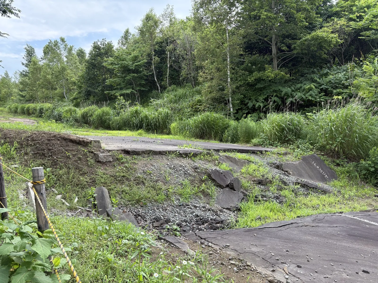
As magma rose from below, the ground bulged and faults slipped, and the town road was severed like this.
What's worth noting is that there were no human casualties. There were warning signs before the eruption — volcanic earthquakes and the like — and thanks to cooperation between the authorities and researchers, residents are said to have been evacuated in advance.
"They predicted the eruption, they fled, and they saved their lives" — that real-world example is preserved here as a monument.
The Lake Toya and Mt. Usu area is designated the Toya-Usu UNESCO Global Geopark, a place to learn how people and volcanoes have lived together.
People have gone on living their lives right beside a dangerous volcano.
That tension, and that wisdom, came through in a single severed road.
| Location | Toyako-cho, Abuta District, Hokkaido |
| Parking | Lot at the trailhead |
| Highlight | The town road uplifted and severed by the 2000 eruption, and the crater cluster |
| Watch out for | It's an outdoor walk — wear walkable shoes; closed in winter |
I’ll note the gelato at Lake Hill Farm, which we stopped for along the way.
We chose the white cream and the sweet corn; the corn’s sweetness came through beautifully, and the milk pie had a refined flavor too.
The Windsor Hotel Toya — a resort looking down over the lake
Our lodging that night was The Windsor Hotel Toya, set high on a rise looking down over the lake.
It’s a luxury resort, best known for hosting the 2008 G8 Summit.
Our room had a Lake Toya view, and in principle we should have been able to see all the way to Nakajima.
But let me be honest here.
Check-in kept us waiting about thirty minutes, and by the time we reached the room the lake had hazed over — the whole point, Nakajima, was hidden.
You can’t do anything about the weather, but given the price, there were moments when the service felt like it fell a step short.
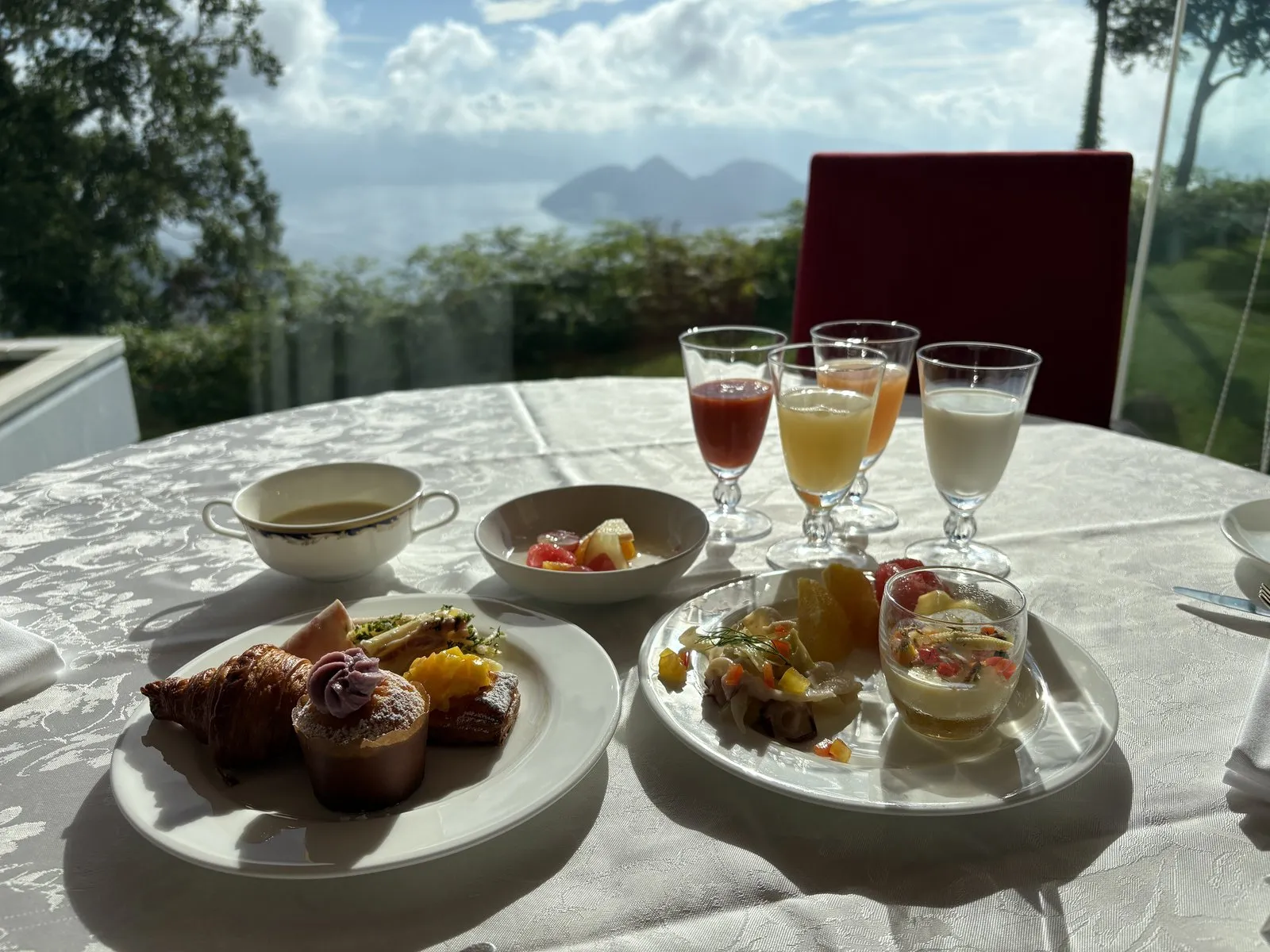
Even so, breakfast the next morning at a window-side table was a lovely thing.
The French toast was meltingly soft, and eating with the lake in view is a location that speaks for itself.
| Location | Toyako-cho, Abuta District, Hokkaido |
| Features | A hilltop resort overlooking the lake; venue of the 2008 G8 Summit |
| Breakfast | Window-side tables with a lake view; French toast and more |
| Watch out for | The lake hazes over easily with the weather — the view is partly down to luck |
The Lake Toya cruise and Nakajima — from the water, into the middle of the caldera
Day two brought a complete turnaround in the weather — clear skies.
We boarded the Lake Toya steamer and set out for Nakajima, floating in the middle of the lake.
As the boat pulled away from shore, the first surprise was realizing just how high up last night’s hotel sat.
Looking up at it from the water, it hit home all over again that it really was a hilltop resort.
Turning back, we could see Mt. Yotei in the distance — the beautiful cone-shaped peak also called the “Ezo Fuji.”
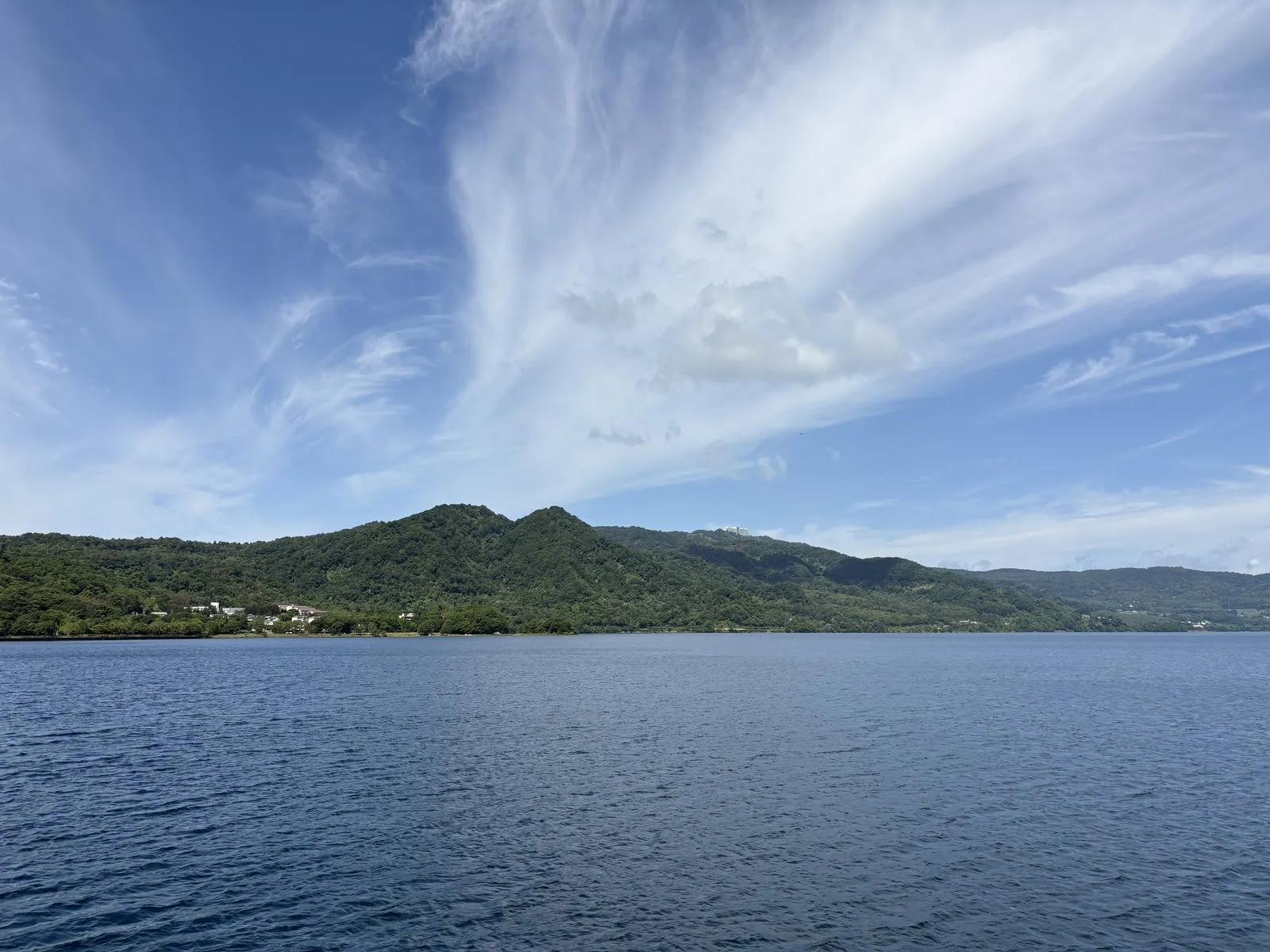
We landed on Nakajima and walked the forest trail.
One step in, the air turned cool, and somewhere the tapping of a woodpecker echoed through the trees.
It was a quiet forest, with the raw power of nature left intact.
And the boat ride back was the best part of all.
Out on the deck, the wind brushed our cheeks, and black-tailed gulls flew right alongside the boat.
The lake water was astonishingly clear, its blue running on and on.
Which means that right now, we were walking the forest of a "later-born volcano" standing in the center of a "hollow (the lake) made by a giant eruption."
From the water, the mountains ringing the lake stood in a long, continuous curve. That round rim is said to be the edge of the caldera.
It's hard to notice while you're out on the lake, but we were, in fact, floating alone in the very middle of an enormous volcano.
To be able to spend such a calm stretch of time in the middle of a volcano.
That, too, was part of Lake Toya’s strange appeal.
| Location | Toyako-cho, Abuta District, Hokkaido (departs from the Toyako Onsen pier) |
| Route | A round-trip cruise to Nakajima; you can walk the forest trail on the island |
| Highlight | The view from the deck, the gulls, Mt. Yotei, and the clarity of the water |
Wakasaimo Honpo’s “Imoten” — fried fresh, with salted kelp inside
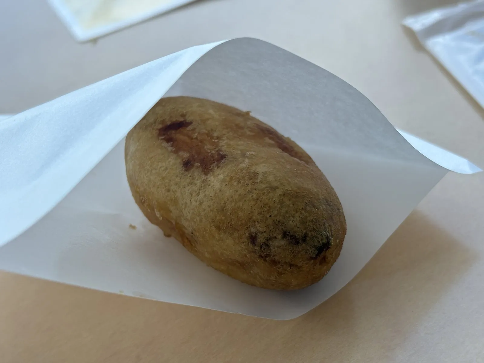
For a lakeside snack we tried the “Imoten” from Wakasaimo Honpo.
It’s made to order, handed over hot straight from the fryer in front of you.
One bite in, the outside is faintly sweet and fluffy.
And then, out of the middle, comes salty shio-konbu (salted kelp) — a fun little twist.
The salt cutting through the sweetness had us reaching for a second before we knew it.
Running into a small local specialty like this is enough to lift the whole mood.
| Location | Toyako Onsen, Toyako-cho, Abuta District, Hokkaido |
| Signature | Freshly fried "Imoten" (with salted kelp inside) |
| Note | Made to order in front of you; an easy stop on a lakeside stroll |
Muroran and the Etomo Peninsula — a cliff-lined coast built by volcanic rock
In the afternoon we crossed the Hakucho Bridge and pushed on to Muroran.
The coast of the Etomo Peninsula, out past Muroran, was the day’s other objective.
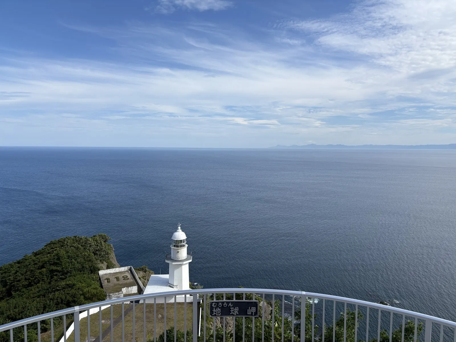
Our first stop was the famous Chikyu Misaki (Cape Chikyu).
Beyond a white lighthouse, cliffs and a wide sea stretch on without end.
That grand name “Chikyu Misaki” — literally “Earth Cape” — does not, it turns out, come from the horizon looking curved.
It comes from a place name of Ainu origin (a word said to mean “cliff”), to which the kanji for “earth” were later fitted — a phonetic borrowing, as it’s said.
Knowing that, the sweeping view took on a layer of the land’s older memory.
From there we followed the coast to the Tokkarisho Lookout.
This one was striking too.
A rice-ball-shaped rock, sharp at the peak, juts out into the sea, its base washed by blue water.
Rock, sea, and the green atop the cliff — the contrast of colors was superb.
Pushing on a little further to Itanki Beach, we found crisp banded strata showing in the rock face and couldn’t help edging closer.
Layer upon layer of sand and mud runs at a slant across the rock.
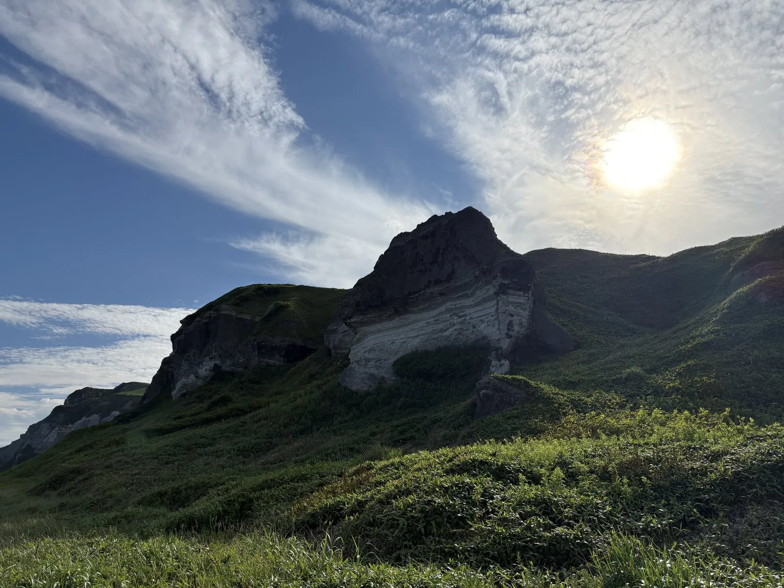
The sheer cliffs at Cape Chikyu and Tokkarisho are said to be hard volcanic rock carved back by the waves of the Sea of Japan. The harder the rock, the harder it is to crumble, so it survives as steep cliffs.
The banded pattern we saw at Itanki Beach is strata — sand and mud that settled and hardened on the sea floor. Movements of the earth tilted it, so the layers now appear to run at an angle.
Near the lookouts we also saw streaks that looked like a dike — a sheet cutting straight through the other rock. A dike forms when magma rising from below fills a crack in the rock and hardens. Here too, at the root of it all lay volcanic activity.
From the Etomo Cape lookout, across the water, we could see Mt. Usu and Showa-Shinzan, and Mt. Yotei further beyond.
It was the moment the view came full circle, from a volcanic island to a volcanic peninsula.
| Location | Muroran, Hokkaido (along the Etomo Peninsula coast) |
| Parking | Lots at each lookout — Cape Chikyu, Tokkarisho, and so on |
| Highlight | The cliffs and lighthouse, the sharp jutting rock, and the strata at Itanki Beach |
| Watch out for | Cliffs and rocks are slippery — stay behind the railings |
Lagorto — a lily-bulb pizza grown from volcanic soil
Back from Muroran to Lake Toya, dinner that evening was at the popular Italian spot Lagorto.
It’s a stand-alone restaurant outside the hotel, and we’d booked an evening seating.
Several groups were already waiting before opening — reserving was the right call.
What we had was food made with lily bulbs (yurine) from nearby Makkari Village.
The lily-bulb pizza came topped with tomato, cheese, onion, bacon, and rosemary, with fluffy, sweet lily bulbs on top.
The crust’s edge was crisp and fragrant, and the gentle sweetness of the lily bulb went perfectly with it.
The plain deep-fried lily bulbs were fluffy too — we couldn’t stop reaching for them.
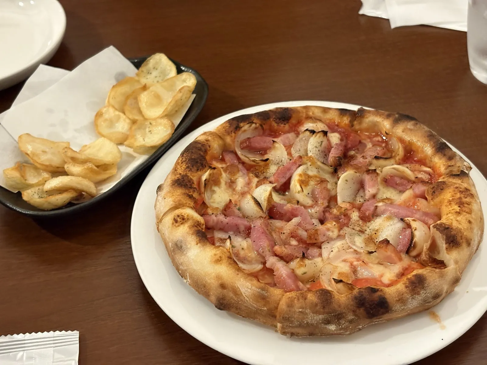
The caprese with Orofure tomatoes was refreshing too — a thoroughly satisfying dinner.
Makkari Village, by the way, is the land spreading out at the foot of Mt. Yotei.
Its well-draining volcanic soil is said to suit growing lily bulbs and vegetables.
Here too, at the root of the food’s deliciousness, was a volcano.
| Location | Toyako-cho, Abuta District, Hokkaido (a stand-alone shop, separate from the hotel) |
| Signature | Pizza and deep-fried dishes made with Makkari Village lily bulbs |
| Note | A popular spot — reservations recommended for dinner |
Day three — the Silo Observatory and a helicopter flight, where everything connected
The final day.
First we looked out over Lake Toya once more from the Silo Observatory.
The view from the rise was as satisfying as ever — the blue of the lake, and Nakajima floating clearly at its center.
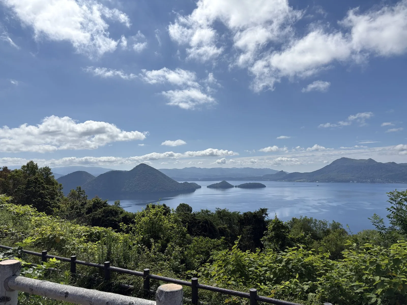
And then, the climax of the trip.
From near the observatory, we took a helicopter sightseeing flight.
This was — truly — the best.
As we lifted gently off and gained altitude, the scenes we’d been seeing separately on the ground merged into a single picture.
You could see, unmistakably, that Lake Toya is a clean, round shape.
Right in its middle floats Nakajima.
And just south of the lake, reddish-brown Showa-Shinzan and craggy Mt. Usu.
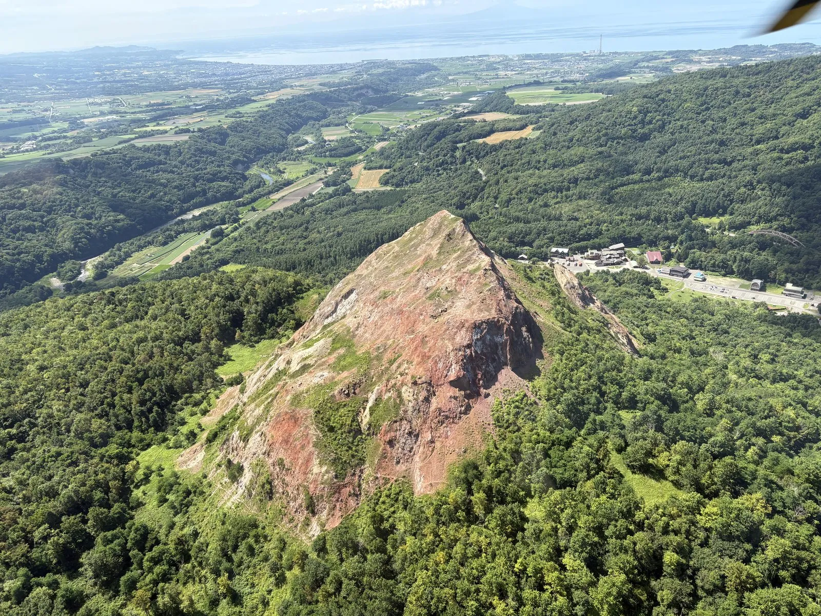
But looking down from the air, you can see at a glance that the lake is almost perfectly circular, with Nakajima floating in the middle.
That circular shape is said to be the outline of the caldera — the ground that collapsed inward during the massive eruption around 110,000 years ago.
And on the southern edge of the circle stand the newer volcanoes, Showa-Shinzan and Mt. Usu, side by side.
An "old caldera" and "new volcanoes," held in a single field of view. The view from the air showed most clearly of all that Lake Toya is still a land of living volcanoes.
To look down with my own eyes, from above, on the Lake Toya I’d only ever seen on television.
Higher than the observatory, closer than an airplane — just the right height.
This helicopter flight became the single best experience of the whole trip.
| Location | Nariwai, Toyako-cho, Abuta District, Hokkaido (Silo Observatory) |
| Parking | Large lot at the observatory |
| Highlight | Lake Toya and Nakajima from the rise; helicopter flights from the adjacent pad |
| Note | Flights may be canceled in bad weather — check ahead |
Closing with a burger from Hidden — a living volcano at the root of it all
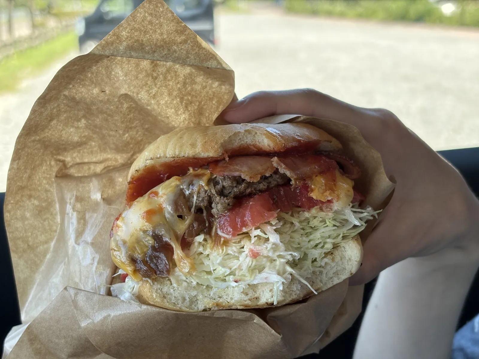
We closed out the trip with a takeout burger from Hidden.
Almost too big to hold, it burst on the first bite with the sweetness of amber-caramelized onions.
The patty was properly good, and the fries on the side were fluffy.
Right to the end, Lake Toya was a delicious trip.
Three days, two nights.
Volcanoes, a caldera lake, a cliff-lined coast, and the view from the air — it was a trip packed with everything.
I’ll be honest: there were moments when Lake Toya itself felt “a little less than I’d expected.”
But looking back, everything that stayed with me was, in some form, a trace of the earth in motion.
A red mountain born from a field.
An active volcano that erupts every few decades.
A single road severed by eruption.
A volcanic island floating in the middle of a lake.
And, seen from the air, a round caldera.
At the root of all of it was a “living volcano.”
From the window on the flight home, we could see Tomakomai and Muroran, Mt. Yotei, Lake Shikotsu, Lake Toya, and even Mt. Komagatake.
Just how full of volcanoes southern Hokkaido turned out to be surprised us one last time.
Volcanoes are frightening things, and also things that create landscapes and food this rich.
It was a trip where we got to confirm both, with our own eyes and our own tongues.
Geological references: Geological Survey of Japan, AIST ("Geology Map Navi"); Geospatial Information Authority of Japan topographic maps; public information from the Toya-Usu UNESCO Global Geopark. Statements written as "is said to" or "is thought to" include prevailing interpretation and estimation rather than settled fact.